Chyron Releases the New AXIS Maps
Chyron’s Cloud-Based Map Graphics Platform Offers More Advanced Maps Features and Ease-of-Use
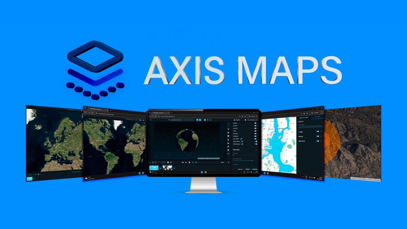
MELVILLE, N.Y. – December 16, 2025 – Chyron officially launched the new edition of AXIS® Maps, a maps graphic creation solution for broadcasters. This next generation of AXIS Maps features game-changing 3D map visuals, enhanced customization options, extensive data layer support, pre-defined settings for admins to ensure consistency across all users, and an intuitive new interface that makes map graphics creation for broadcasters faster and easier than ever before.
First shown during IBC 2025, visitors were impressed by its new, powerful set of easy-to-use features. Now, after final testing, Chyron has officially released it. The release also includes an integration with AWS Cognito to enhance security and simplify login across the entire AXIS platform, allowing Single Sign-On (SSO) authentication via major identity providers (like Google, Microsoft, or Okta).
The new edition of AXIS Maps is part of Chyron’s greater AXIS ecosystem, a cloud-based platform that helps journalists, producers, and designers easily find, manage, request, and create the visuals that bring stories to life, from maps and news graphics to charts and financial data.
“The New AXIS Maps was designed to provide broadcasters with a solution that enhances their existing newsroom workflow with powerful yet easy-to-use tools, and we’re proud to say we ended up with a solution that enables studio-quality map visuals creation with just a few clicks,” said Peter Matis, product manager of AXIS. “We’re fortunate to work with customers who are deeply engaged and willing to share their insights. They are the impetus for every new feature and enhancement included in the evolution of AXIS Maps.”
The new AXIS Maps provides broadcasters with the tools they need to captivate modern audiences with cutting-edge map visuals. Now, they can enrich their graphics with immersive 3D buildings and terrain elevation data layers, alongside other new data layers that help provide context, such as bridges, tunnels, parks, and airports. They can also import custom data for specific analysis. Additionally, there are new graphic tools designed to easily highlight areas of interest within a map, such as custom routes, 3D polygons, or border coloration at national, regional, district, city, or local levels, providing more flexibility for broadcasters to turn complex information into visually engaging narratives.
Ease-of-use has been a key focus when designing the New AXIS Maps. The map visuals creation now may take only seconds, depending on the level of detail the story requires, and can be performed by any user, regardless of their skill set. In addition, this release empowers broadcasters with tools to maintain visual consistency across productions by standardizing the language in which countries and city names are displayed, along with how custom graphic elements, such as Street and Area labels, are showcased.
For more details on its features and enhancements about the New AXIS Maps, visit our landing page.